Tophography and vegetation

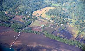
Topography. Generally rugged, with 70 percent mountains and hills. The rest are coastal plains and valleys traversed by brooks and rivers that provide adequate underground water.

climate


Bounded on three directions by bodies of water, Misamis Occidental is known to its neighbors for beautiful waters and bountiful fish and seafood for export. In fact, Layawan River in Oroquieta City is a constant awardee of the national environmental recognition, Gawad Pangulo sa Kapaligiran, as Cleanest Inland Body of Water. But there is one other place that is drawing tourists into this coastal yet rugged province – the city of Tangub, which comes alive especially at Christmas.
soil type

Soil Type

Soil Type

Soil of the uplands consisting of 64.65% of the total area is composed mostly of Adtuyon Clay Loam and Guimbaloan Clay Loam. Other types were Adtuyon Loam, Baliangao Clay Loam, Castella Clay Loam, Jasaan Clay Loam.

The 6.316% of the total area were soil of lowlands which type belongs to Bantog Clay, Kabacan Clay, Mabini Sandy Loam, Pulopandan Sandy Loam and Quingua Silt Loam. The miscellaneous type which consist of 28.93% were of Beach Sand, Hydrosol Mountain soils and a 0.21% unsurveyed.

Climate and Rainfall

The climate of this province belongs to the fourth type where rainfall is more or less fairly distributed throughout the year. The rainiest month is November and the driest month is February. The entire province is outside the typhoon belt, but it is sometimes affected by freak storms.


Land Area

land are3a

LAND AREA

The province has a total land area of 2,024.18 square kilometers representing 65 percent of the total land area of the Philippines. Tudela has the biggest land area equivalent to 13.8 percent of the total province area. The municipality of Panaon shares the smallest area of only 46.80 square kilometers.

Geography

Geography

Misamis Occidental is located near the narrow strip of land linking Northwestern Mindanao, to the Northcentral part of the island. Shaped like a collapsible fan it is bounded on the northeast by the Mindanao Sea, east by the Iligan Bay, southeast by the Panguil Bay, and the west by the Zamboanga del Norte and Sur. The fact that three of its boundaries are bodies of water gives away water life as one of its natural resources and fishing as one of its main industries. Except along the coastal area, hilly and rolling land characterized the provincial terrain. Towards the western border, the terrain is particularly rugged.

Climate

Climate

The climate belongs to the Fourth type where rainfall is more or less fairly distributed throughout the year. The average rainfall in the past twenty years was recorded at 182.5 millimeters. The rainiest months are November and December; the driest are February, March, and April. The entire province is outside the typhoon belt but it is sometimes affected by freak storms.